
Aerial 3D Rendering Services
Renderings made to win the decision.
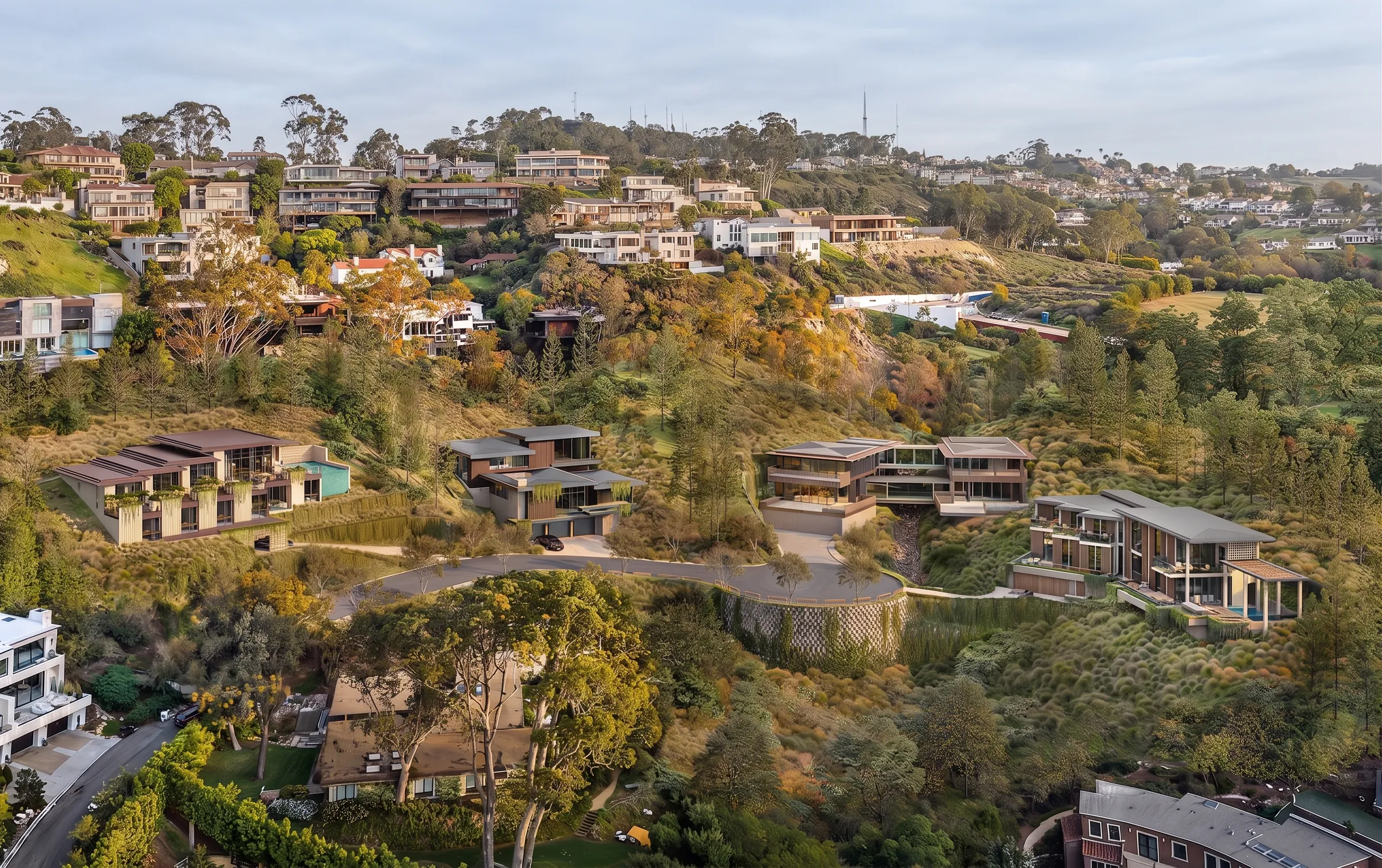
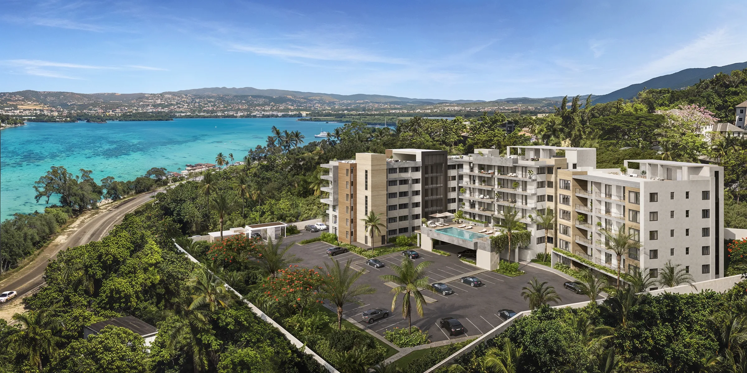
The whole project, in its real setting, seen from above before it is built. Bird's-eye, masterplan and site plan views, on real context or drone photography.
Clients and collaboratorsFoster + PartnersRegentLinkedInMarriottCapri HoldingsCapital One
Some questions cannot be answered from the street.
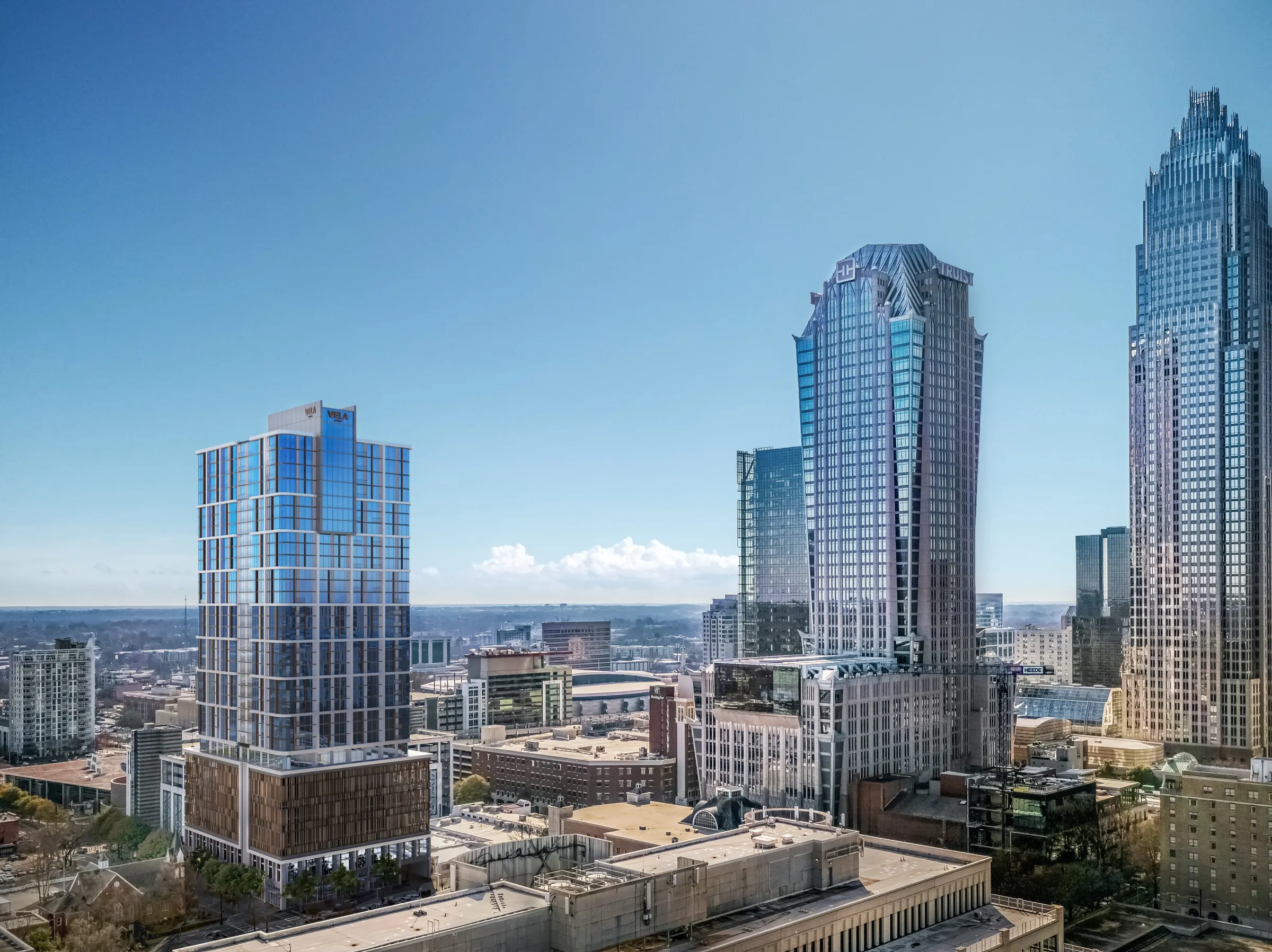
Aerial rendering is photoreal visualization of a building, a community or a whole site from a bird's-eye view, set into its real surroundings. NoTriangle Studio, a 3D architectural visualization studio headquartered in the San Francisco Bay Area (Fremont, California), founded in 2014, creates aerial and masterplan renderings for developers and architects across the US, Canada, the Caribbean and internationally. For VeLa Dev Partners, 12 aerial exteriors of towers in six US cities, built on drone photography, supported planning approvals. Read the case study
Selected work
Selected Aerial Projects
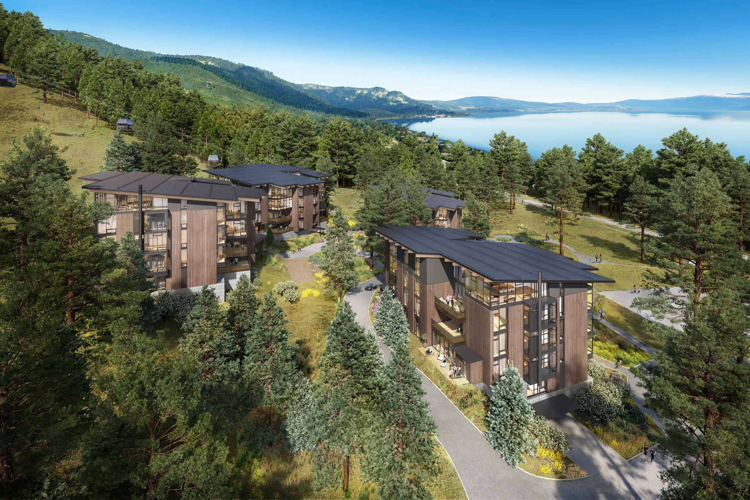
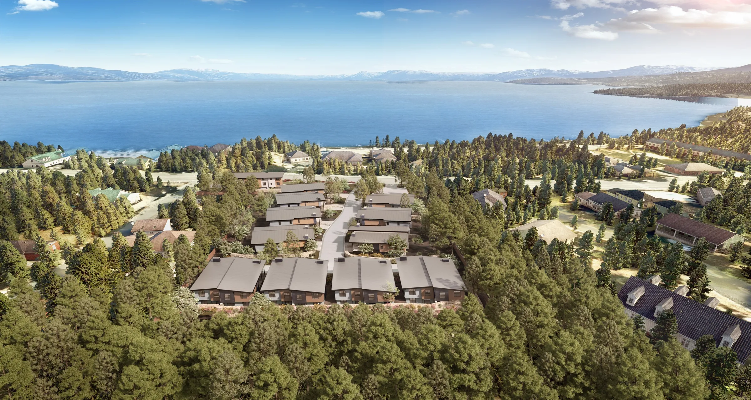
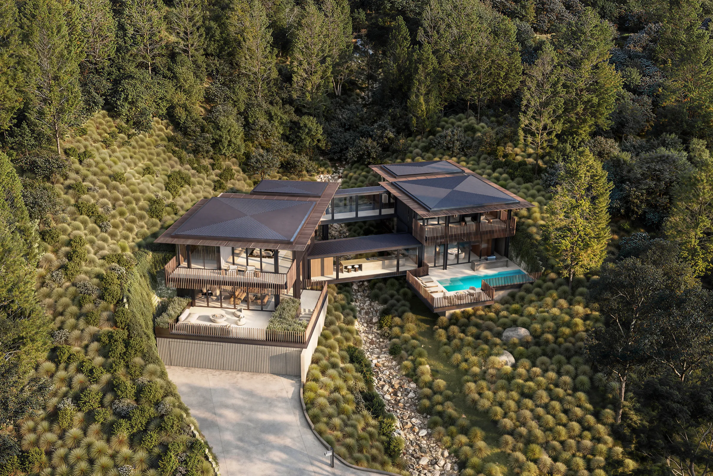
Homewood Mountain Resort, Lake Tahoe
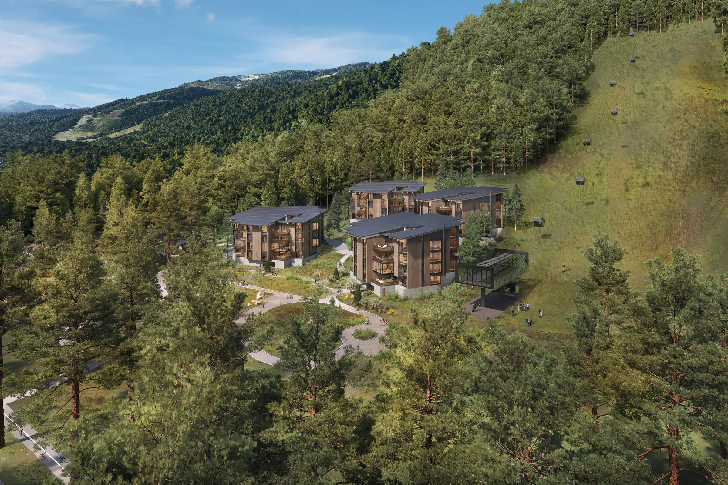
For the North Base residences on the West Shore of Lake Tahoe, an aerial master-plan view and eye-level views in summer and winter were made for the Placer County entitlement and design review submission.
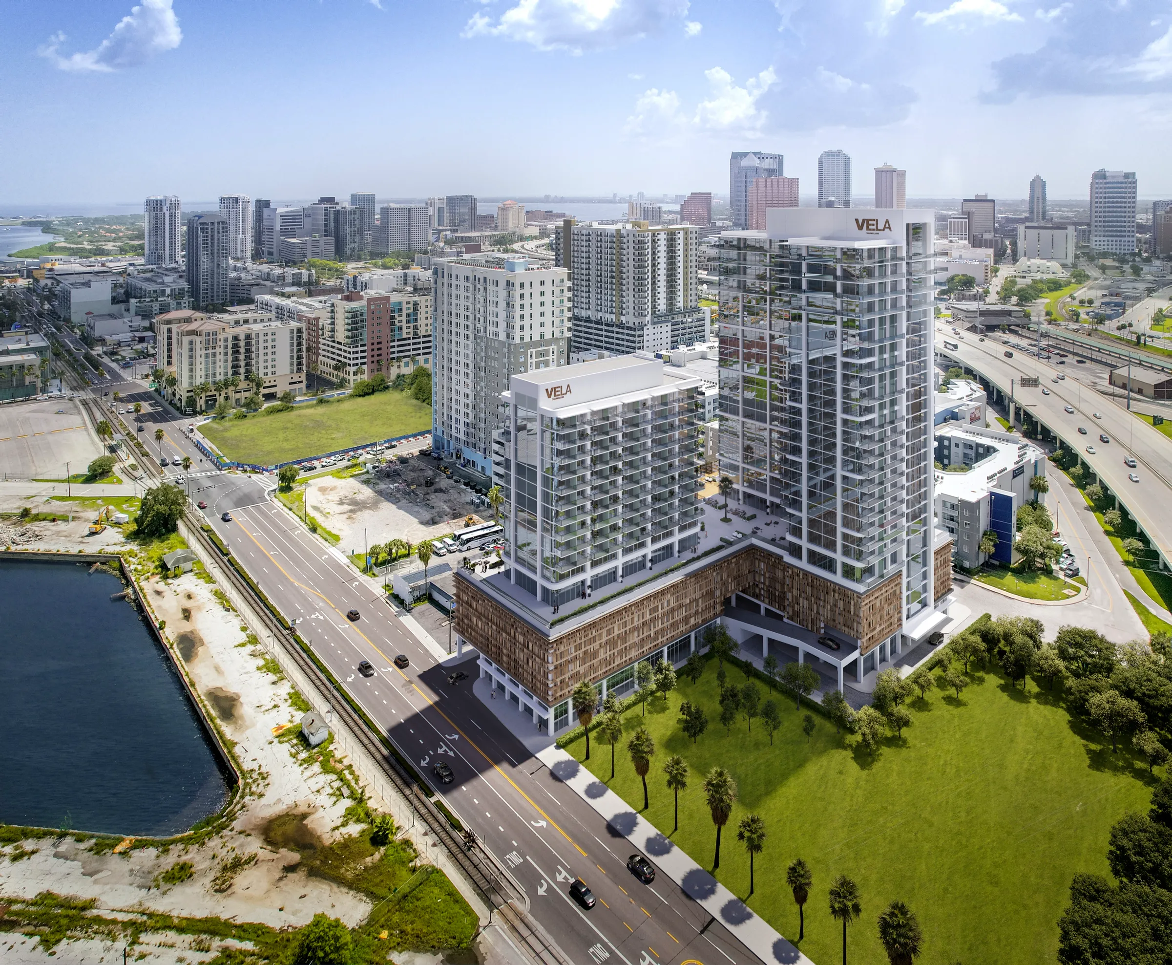
Read the Homewood case studyVeLa Developments, six US markets
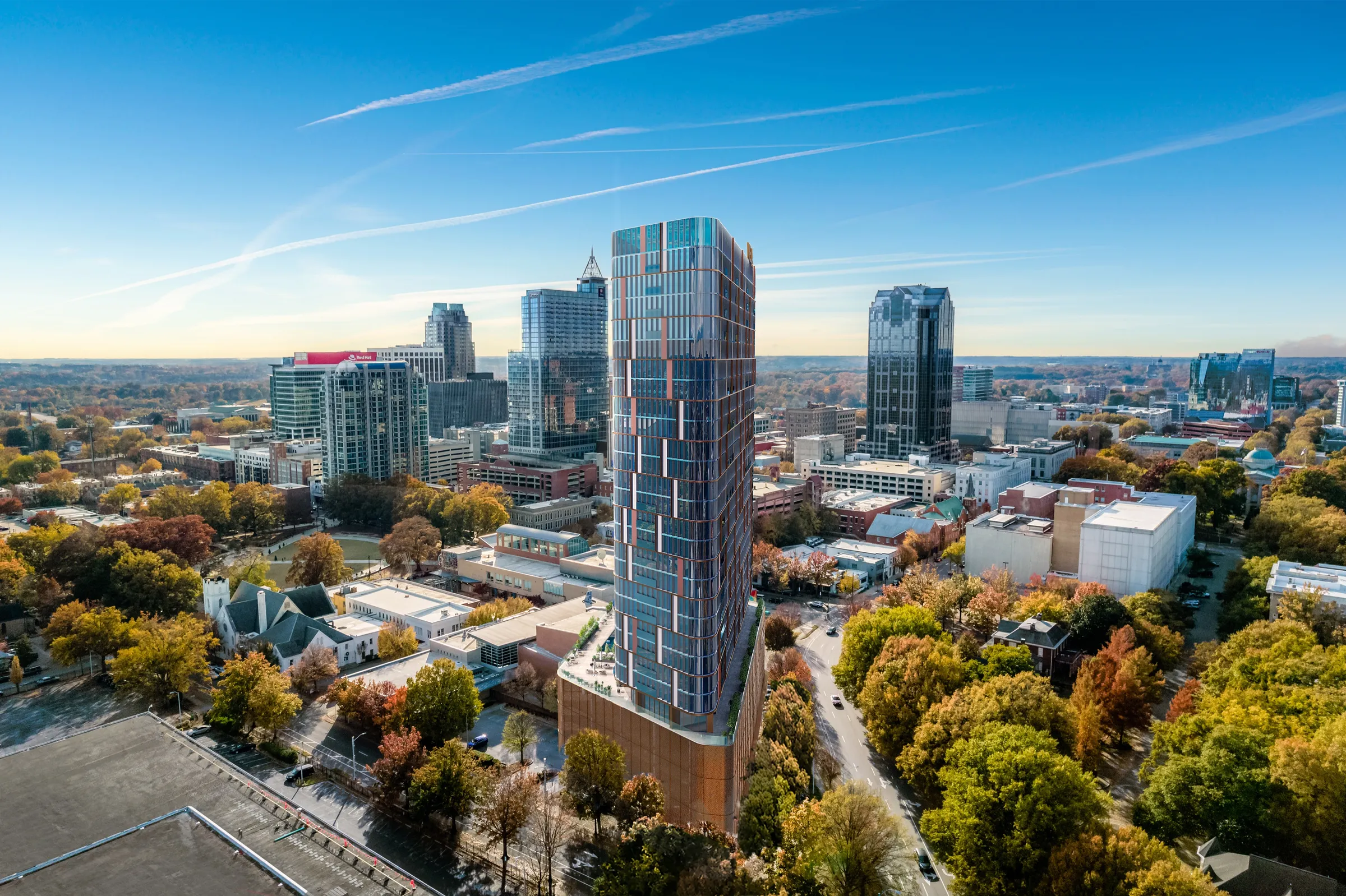
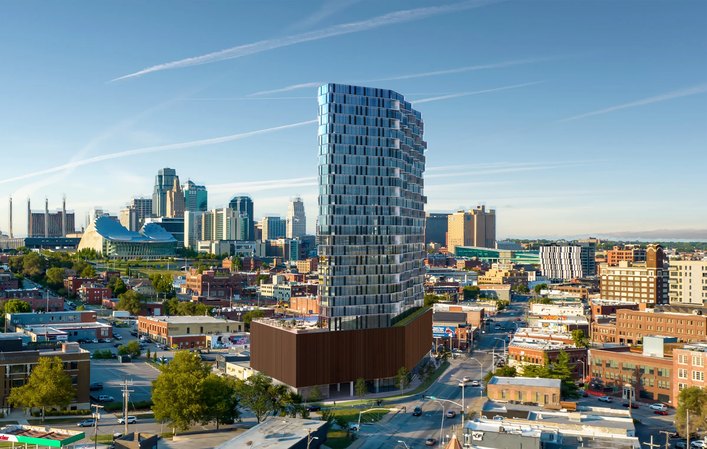
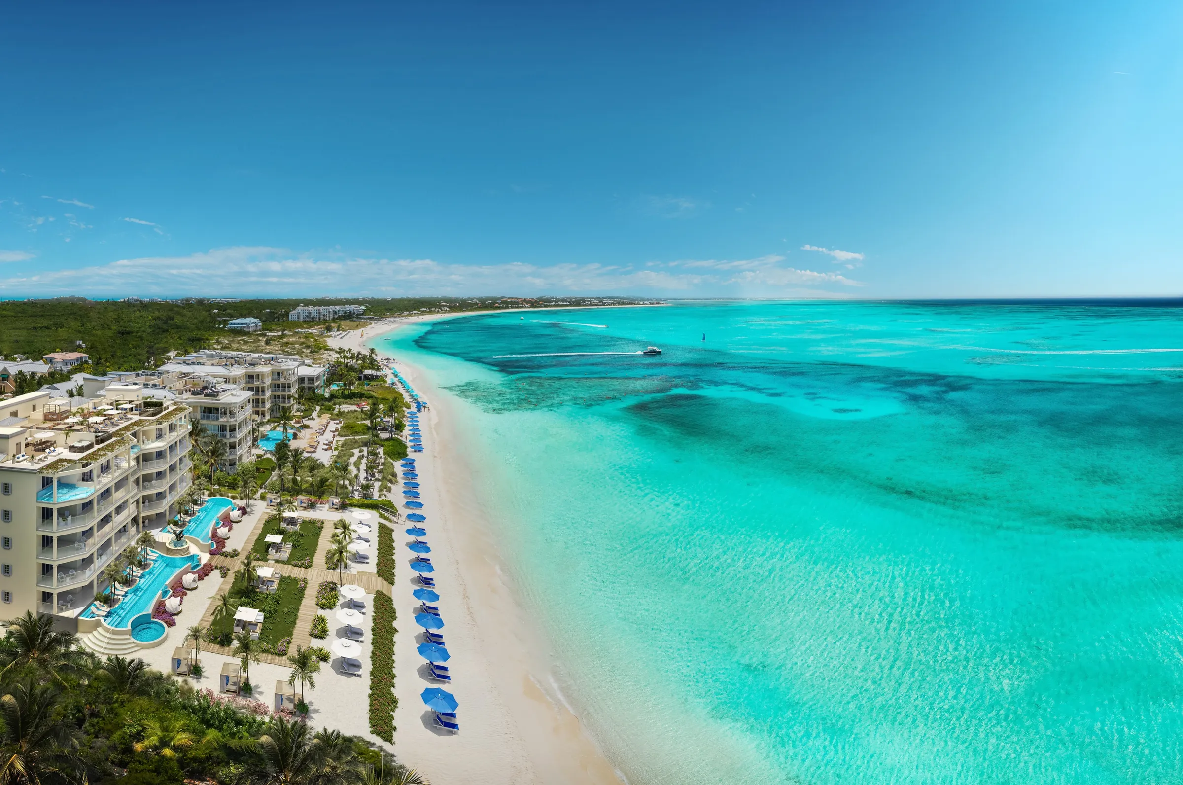
For VeLa Dev Partners, 12 aerial exteriors of towers in six cities, built on drone photography, supported planning boards. Approvals followed in Tampa, Raleigh and Charlotte, and the Phoenix tower opened in 2026.
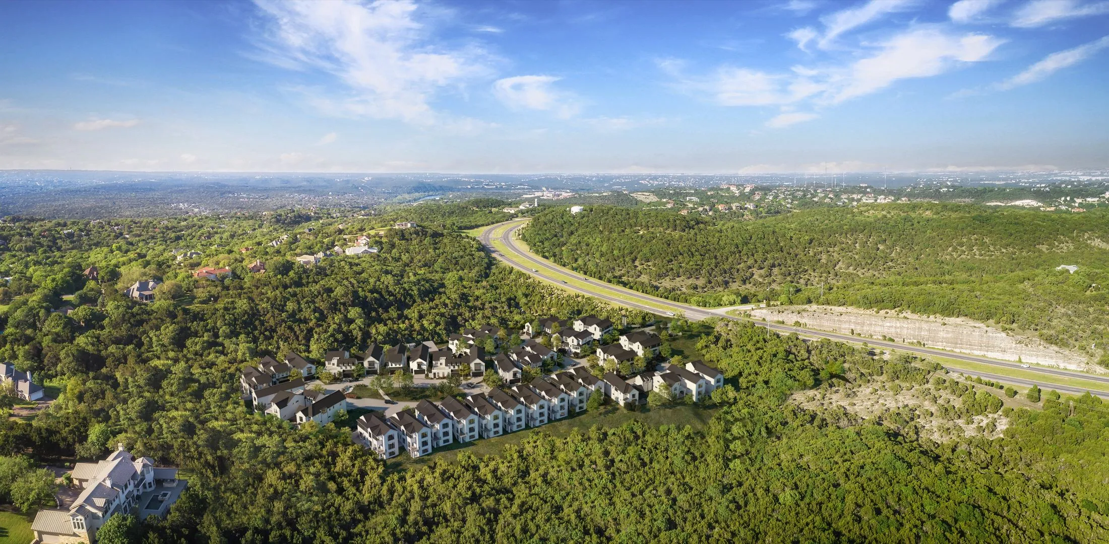
Read the VeLa case studyThe Addie at Westlake, Austin
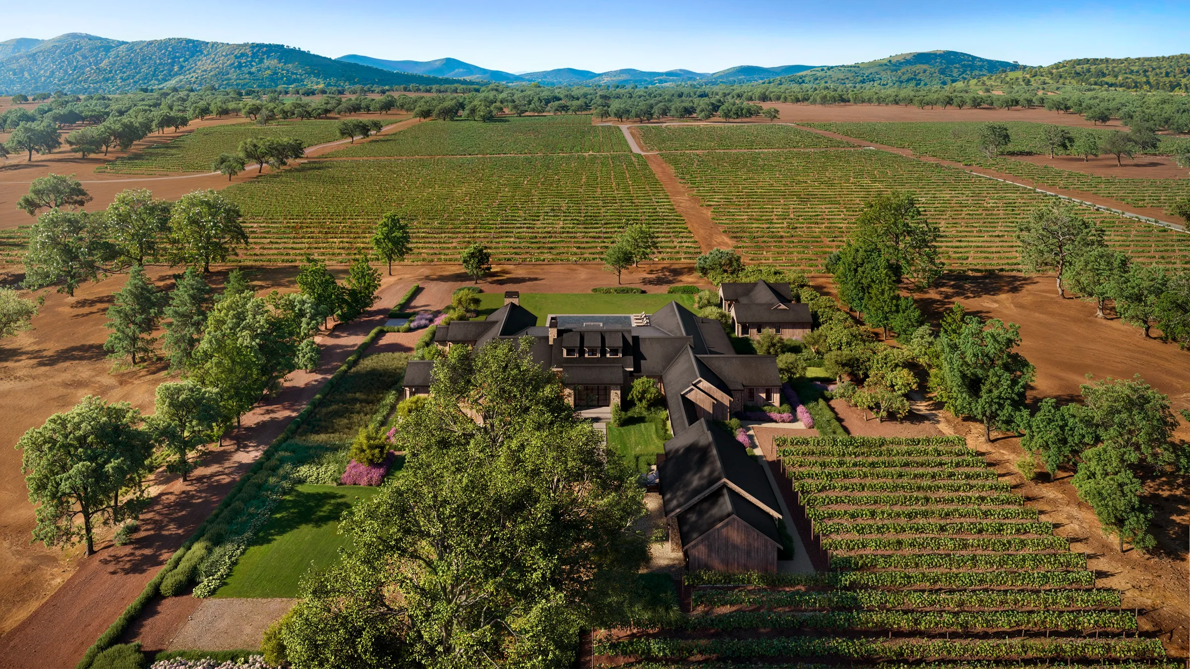
A 46-home gated community in the Westlake Hills. Exterior and interior renderings, an animation and furnished floor plans launched pre-sales before any home existed, and the community sold out.
Read the Addie at Westlake case study
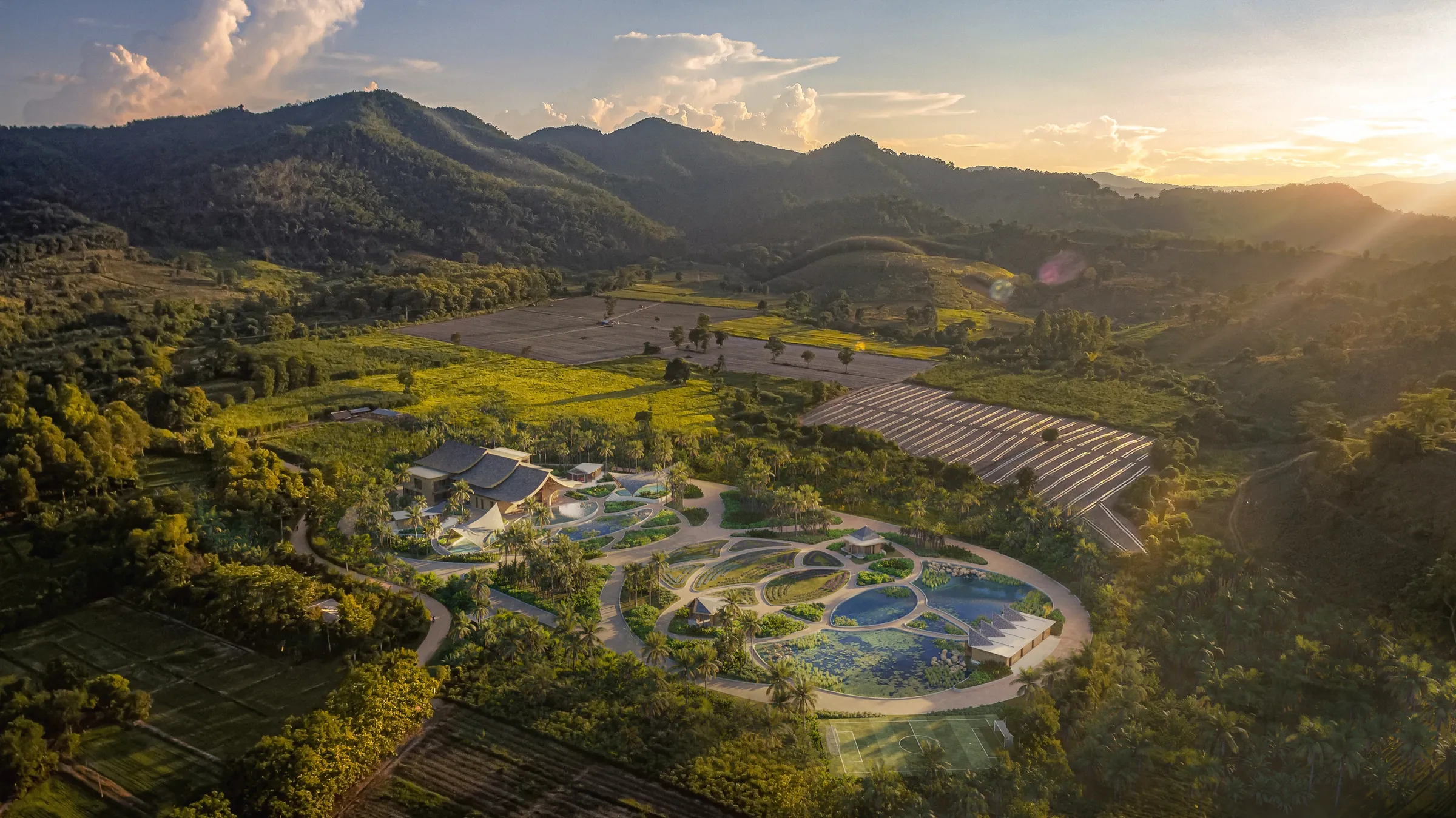
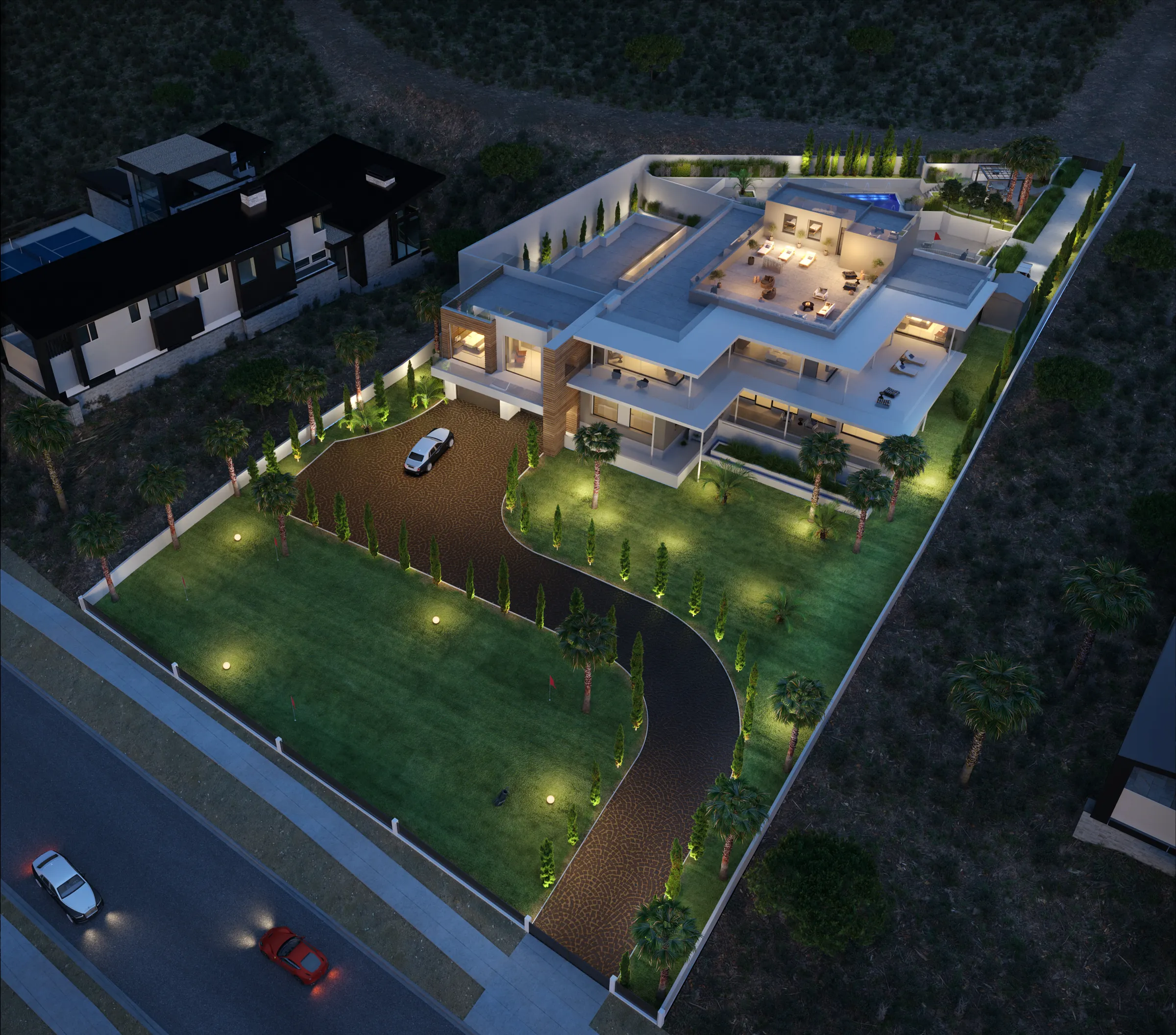
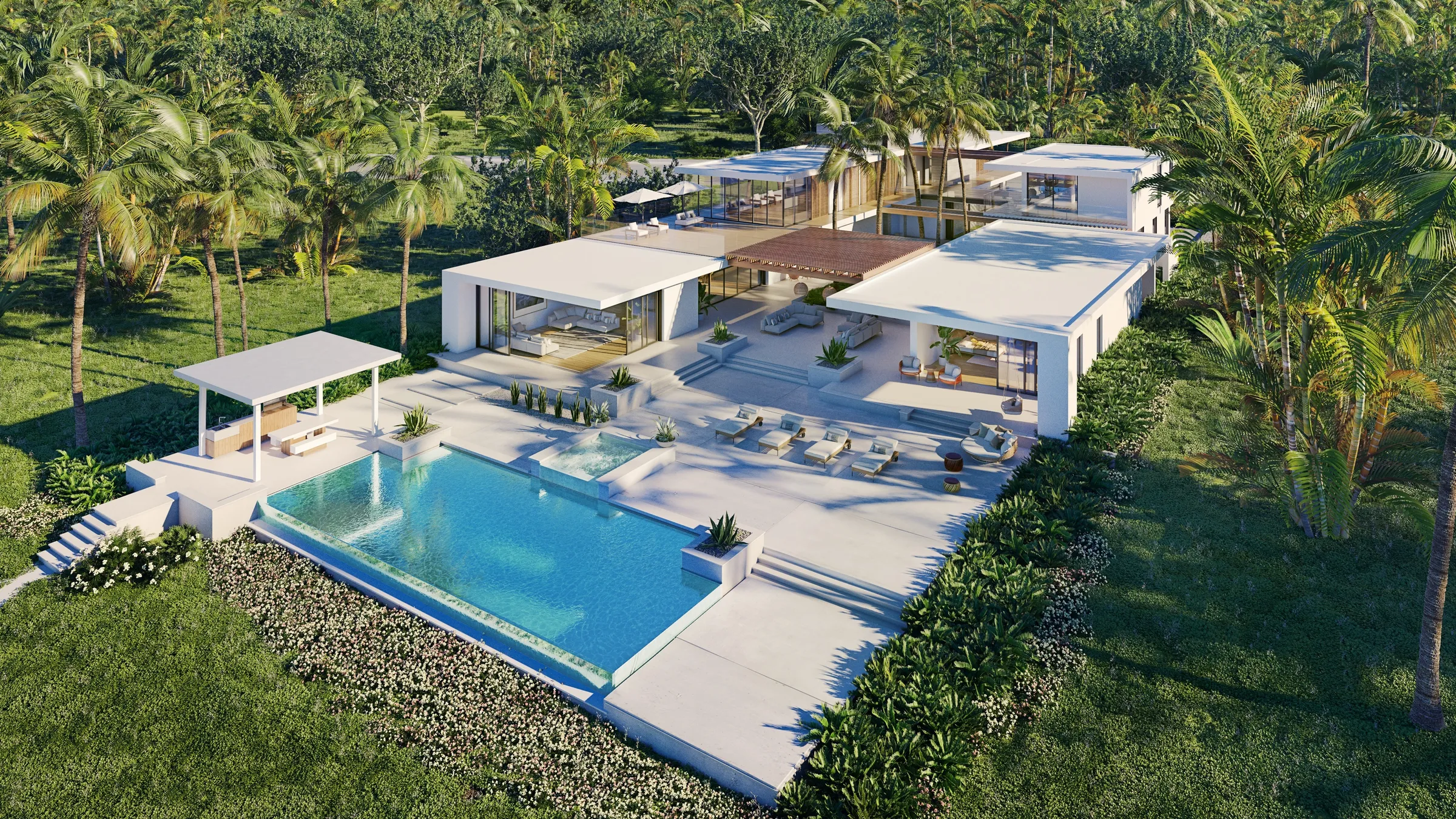
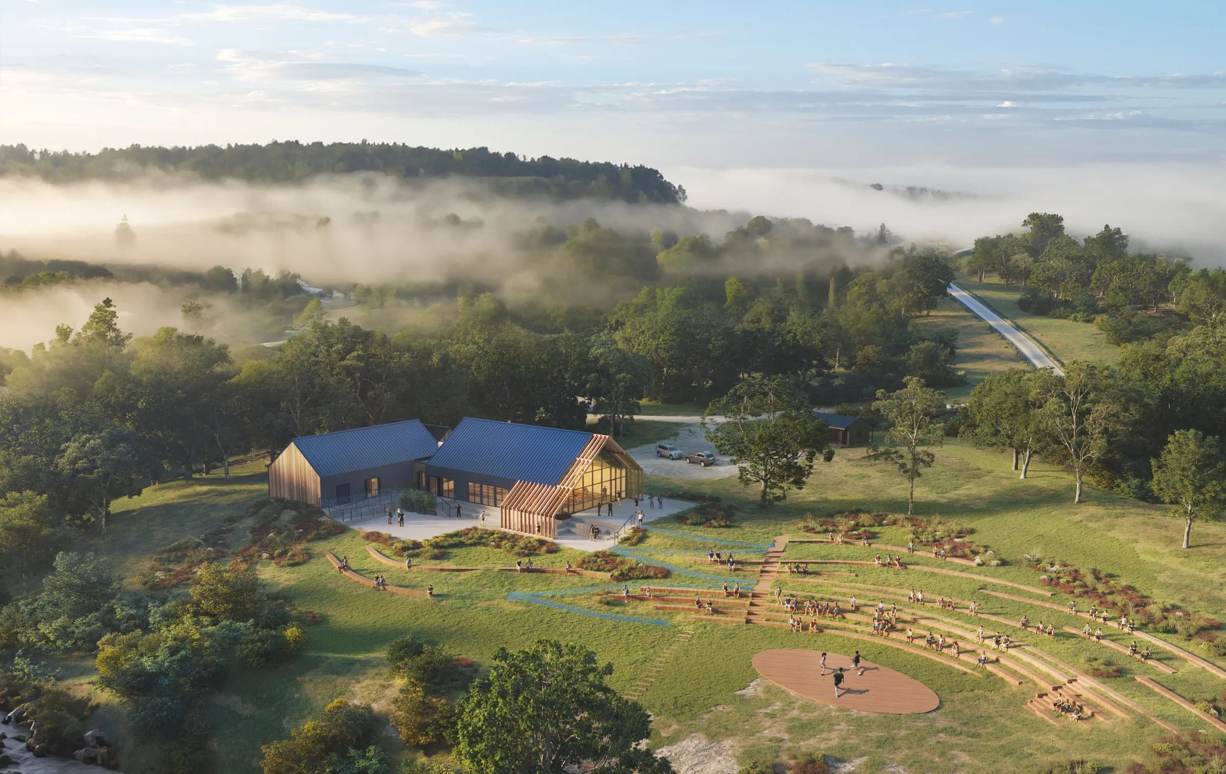
Concept work: a retreat community in Thailand. Six renderings for Peter Lombardi Architects' unbuilt retreat in a rural Thai valley, the aerial made as a drone photomontage, for fundraising and concept presentation. A concept, not a constructed project. Read the Thailand retreat case study
What it does
What an Aerial Rendering Does
Some questions cannot be answered from the street. How big is the site? What is next to it? Where is the water, the ski lift, the highway, the city? How do the buildings, the roads and the amenities fit together? An aerial answers all of them in one image, which is why it so often opens the brochure, the investor deck and the planning submission. We start from the question the people deciding will ask, and choose the height, the angle and the light that answer it.
- Scale and setting in one image
- An aerial shows the whole project at once: how big it is, what surrounds it, where the water, the hills or the skyline sit, and how the buildings relate to each other. A street view cannot answer those questions.
- Layout people can read
- Roads, entrances, lots, amenities and landscape read clearly from above. For a community, a resort or a masterplan, the aerial is often the one image that explains the whole plan to a buyer, an investor or a review board.
- The image that anchors the set
- An aerial usually opens a brochure, an investor deck or a planning submission, and the street-level and interior views follow it. Because they all come from the same model, the set stays consistent.
Aerials in motion
Pre-launch film for Sankari Place, Regent Residences, Business Bay, Dubai, aerial and close views from one model
Types of aerial views
Aerial View Rendering: The Views We Make
Bird's-eye context view
An angled view from above that places the project in its neighborhood, its landscape and its views.
Best for: a single building or a small community in its setting, and the location page of a brochure.
Masterplan and site plan
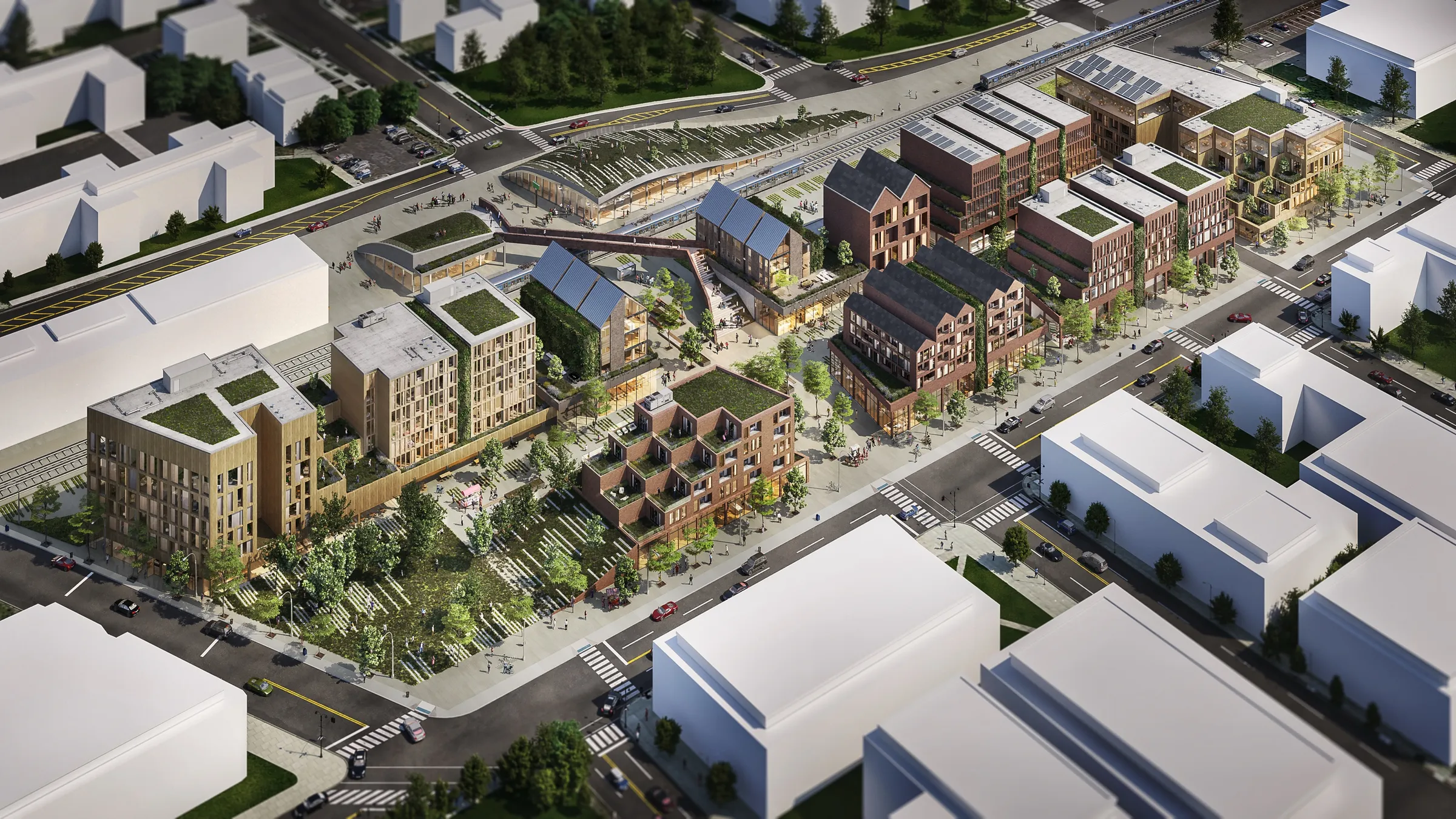
Lots, streets, paths and amenities read at a glance, for communities, resorts and mixed-use districts.
Best for: master-planned communities, resorts and phased sites, in planning submissions and sales centers.
Oblique hero aerial
A lower, drone-height view that keeps the architecture large in the frame, often the lead image of a launch.
Best for: the lead launch image of a single project, where the architecture has to stay large.
Skyline and tower context
A tower set into its real city, so stakeholders see how it sits among its neighbors.
Best for: towers and urban infill, design review and investor decks.
Dusk and night aerials
The same view at twilight, with the buildings, streets and pools lit, for the image a launch leads with.
Best for: the hero image of a launch, billboards and the opening of a film.
Aerials on drone photography
The 3D model placed into real drone or aerial photography of the site, so the setting is the real one.
Best for: sites where the real surroundings sell the project, such as water, mountains or a skyline.
Aerials also work in motion: a flyover that opens on the whole site and moves down to the arrival, or a phasing film that shows the community growing stage by stage, both built from the same model as the stills. See architectural animation and the Sankari Place film above.
Towers in their skyline have their own page: skyscraper and high-rise rendering. Street-level and twilight views of the same project sit under exterior rendering.
Who it's for
Who It's For
- Developers launching pre-sales or raising capital for a community, a resort, a tower or a single estate.
- Architects and planners taking a site through entitlement, planning and design review.
- Multi-unit and mixed-use developers presenting a masterplan to lenders, partners and the city.
- Agents and resort marketers selling a lot, a villa or a community before it is built.
Process
How an Aerial Project Runs
We gather the site data, model the context the views need, and approve every aerial camera on a white model before color goes on.
10+
Years in the industry
500+
Projects since 2014
150+
Clients
20 to 30
People, all in-house
Quick Answers
- What it is
- Renderings of a building, a community or a whole site seen from above, set into their real surroundings, for pre-sales, capital raises and approvals.
- What's included
- Bird's-eye and oblique aerials, masterplan and site plan views, skyline context, dusk and night versions. The same model extends into street-level views, interiors and a flythrough.
- What we need from you
- Drawings or the 3D model, the site location, the landscape plan if there is one, and any drone, survey or site photos. We can model the surrounding context if needed. What files to send
- How long
- It depends on the size of the site and how much context the views need. The schedule is confirmed in the proposal, once we understand the scope and your deadline. Timelines FAQ
- What it costs
- Published 2026 industry guides list about $800 to $4,000 for an aerial, higher than a street-level exterior because of the extra context modeling. These are industry-wide 2026 ranges, not NoTriangle prices. Every NoTriangle project is priced to its scope once we have reviewed it; there is no price list. Cost guide
FAQ
Frequently Asked Questions
What is an aerial 3D rendering?
An aerial 3D rendering is a photoreal image of a project seen from above, as if from a drone, a helicopter or a plane, made before the project is built. It shows the buildings together with their setting: the scale of the site, the access, the views, the amenities and how the project sits in its neighborhood. Developers use aerials for pre-sales and capital raises, and architects use them for planning and design review.
How is an aerial rendering different from a drone photo?
A drone photo shows the site as it is today; an aerial rendering shows the project that will be built there. The two often work together: for VeLa Dev Partners the tower aerials were built on drone photography, and for a retreat community concept in Thailand the aerial was a drone photomontage. Where the site is raw land or a drone cannot fly, we model the context instead. Our drone footage and 3D rendering post goes deeper.
What is the difference between an aerial and a site plan rendering?
A site plan rendering looks straight down and reads like a plan: lots, streets, paths and landscape. An aerial is an angled view from above that also shows height, massing and the setting around the site. Masterplans often need both. For Homewood Mountain Resort, the aerial master-plan view framed the residential lots, the street layout and the gondola route in one image.
How much of the surrounding context do you model?
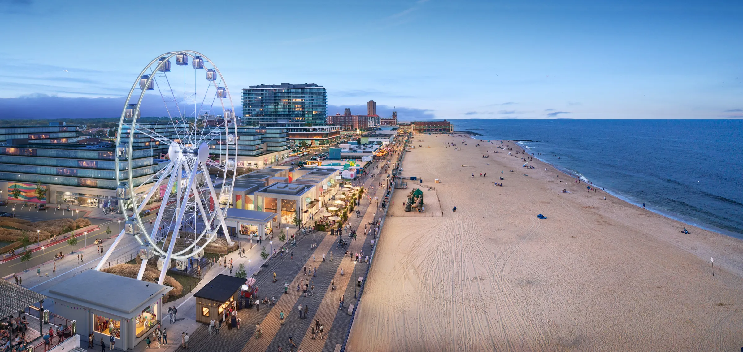
As much as the view needs to answer its question. A single estate may need its lot, the neighboring homes and the landscape; a tower needs the skyline around it. Depending on the site, we work from drone or aerial photography, build viewpoints from a flight-simulator model of the city, or source accurate 3D models of neighboring buildings in well-documented city centers. For a concept, the surroundings can stay as simple white massing, as in the Asbury Park Transit Hub masterplan concept.
Can you render a whole masterplan or community?
Yes. Recent aerial work includes the North Base residences at Homewood Mountain Resort on Lake Tahoe for county entitlement and design review, Alpine View Estates, 25 residences on a wooded site in Tahoe Vista, The Addie at Westlake, a 46-home gated community in Austin that sold out, and the Asbury Park Transit Hub, a transit-oriented masterplan concept by Workshop/APD.
What do you need from us to start?
The architectural drawings or the 3D model, the site location, the landscape plan if there is one, and any drone, survey or site photos. If you already know which views matter (the arrival, the water, the amenities), tell us on the call. Our guide to the files needed for 3D rendering lists the rest.
Can the same model make the film and the street views?
Yes. The model built for the aerials also carries the street-level views, the interiors and a flythrough, so extending the project does not mean starting over. For Sankari Place in Dubai, the twin Foster + Partners towers of the first upper-luxury standalone Regent Residences, the studio produced a pre-launch film alongside a full set of marketing renderings.
Explore further
Further reading
Where we work: aerial renderings for projects in New York, the Hamptons, New England, Los Angeles, San Francisco, Lake Tahoe, San Diego and Orange County, Texas, Phoenix and the Desert Southwest, Florida, Nashville and the Southeast, Chicago and the Midwest, Utah and the Mountain West, Seattle and Puget Sound, Vancouver, Toronto and the GTA, the Caribbean and Dubai.
Tell us about your development.
We review every enquiry personally. Tell us what the project is, where it stands and what it has to achieve, and we will come back with how we would approach it and whether we are the right studio for it.