Marketing Land or a Lot Before Anything Is Built

Lukas Berezowiec · CEO of NoTriangle Studio·June 5, 2026 · 6 minutes
Selling raw or entitled land is hard because the buyer has to picture the upside themselves. A flat lot, a zoning designation, and a price do not show anyone what the parcel could become. Visualization closes that gap by putting the potential on the table, credibly, before a shovel is in the ground.
This is how that works for land and lots, and how the design side is handled when a project arrives without a finished design.
Selling the Potential, Not the Dirt
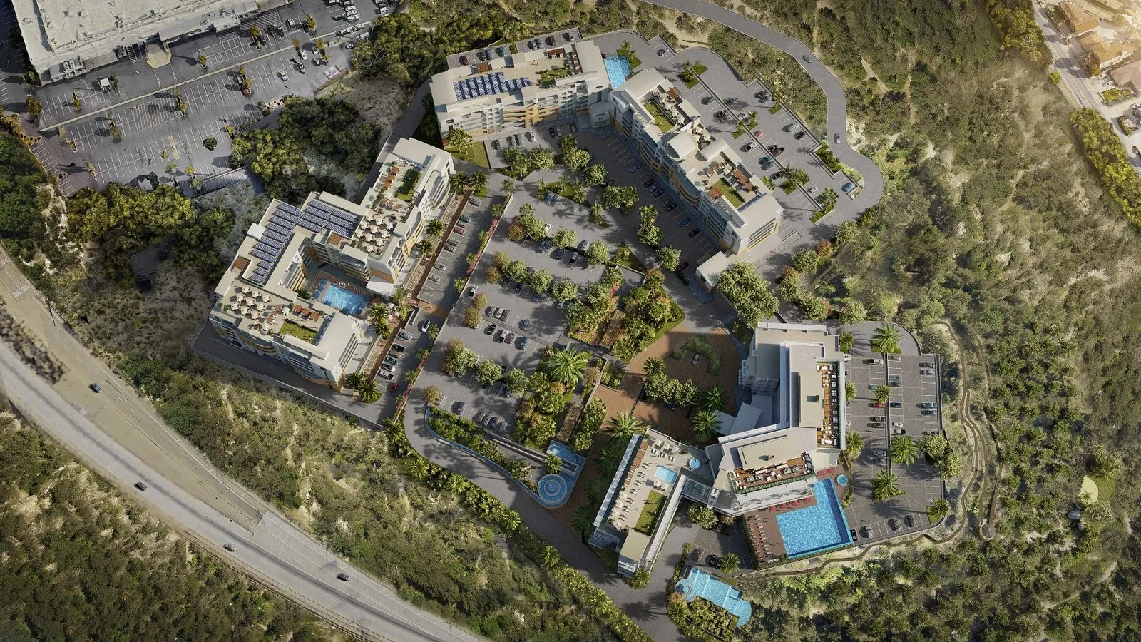
A parcel of land is worth what someone believes can be built on it. Visualization makes that belief concrete: an aerial view that places the site in its setting, a site plan that shows how a scheme fits, and exterior renderings of what could stand there. Suddenly a buyer or an investor is looking at an outcome, not a guess.
This is a common and powerful use of 3D, and it draws on the same aerial and site-plan work that supports larger projects, placing a development in its real context and communicating scale.
Best for Entitled or Shovel-Ready Land
Visualization works hardest where there is something real to show potential against. Entitled or shovel-ready land is the strongest case: the zoning, the envelope, and the constraints are known, so the imagery can show a buildable outcome rather than a fantasy. That credibility is what makes the visuals persuasive to the people writing the cheque.
When There Is No Design Yet
Often, land arrives without a complete design. That is not a blocker, it just means design becomes part of the scope. We can define and price design work separately and run it ahead of visualization, so what we show is buildable and credible rather than speculative.
Because design adds both cost and time, we flag it in the proposal rather than mid-project. It can range from resolving a single unfinished piece to developing a scheme that gives the parcel a sellable identity. There is more on what we need to begin in our guide to the files needed to start a project.
Keeping It Credible, Not Speculative
The risk with marketing land is overselling, showing something that could never be approved or built. That does more harm than good once a serious buyer or their advisors look closely. We keep the imagery anchored to what the site actually allows, the real envelope, the real context, the real constraints, so the visuals strengthen the case rather than undermine it.
FAQs
Can you create renderings to market land before anything is built? Yes. Showing buyers what a parcel could become is a common use, particularly for entitled or shovel-ready land.
What if the land has no design yet? Design becomes part of the scope. We define and price it separately and run it ahead of visualization so the imagery is buildable, and we flag it in the proposal.
What visuals work best for land? Aerial and site-plan views that place the parcel in its setting and communicate scale and context, alongside exterior renderings of a credible scheme.
How do you keep it from looking speculative? By anchoring the imagery to what the site actually allows, the real envelope, context, and constraints, rather than an idealized version that could not be built.